The East Branch DuPage River Watershed drains an area of approximately 82 square miles within the central portion of DuPage County. From its headwaters near the Village of Bloomingdale, the East Branch flows in a south to southwesterly direction approximately 24 miles through residential, commercial and recreational areas of the communities of Bloomingdale, Glendale Heights, Lombard, Glen Ellyn, Downers Grove, Lisle, Westmont, Woodridge and Naperville. The River – Dumoulin Pump Station is the East Branch in the Village of Lisle between the I-88 Tollway and Maple Avenue. Also nearby is a levee system built by the then State Division of Waterways in the 1960’s to protect the area from flooding.
A total of four pump stations were constructed in 2009 along the East Branch between Lacey Avenue and Burlington Avenue in Lisle to help alleviate standing water that accumulates on the landward side of the levee. The pump stations are located on the residential side of the river embankment at the toe of the embankment side slope. The locations were selected to be at relative low spots as indicated by topography. Surface stormwater must rise to a level that will enable it to flow overland to the pump station gravity inlets. The pump stations will then pump the stormwater over the levee into the East Branch DuPage River.
The four pumping stations minimize area flooding from small to medium sized storms. However, these stations are not designed to alleviate surface ponding, to prevent area flooding for major storm events or to prevent flooding when the river flow overtops the levee embankment. The local areas are relatively flat and ponding will continue to occur in low spots, because the general drainage patterns in the subdivision will remain unchanged.
Pump Station & Gravity Drains![River Dumoulin12[1]](Stormwater Management/Images/Flood Control Operations/River Dumoulin12[1].jpg)
Gravity Drains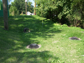
Want to learn more about DuPage County?
Search 


-
- English
- Afrikaans
- Albanian
- Arabic
- Armenian
- Azerbaijani
- Basque
- Belarusian
- Bengali
- Bosnian
- Bulgarian
- Catalan
- Cebuano
- Chinese (Simplified)
- Chinese (Traditional)
- Croatian
- Czech
- Danish
- Dutch
- Esperanto
- Estonian
- Filipino
- Finnish
- French
- Galician
- Georgian
- German
- Greek
- Gujarati
- Haitian Creole
- Hausa
- Hebrew
- Hindi
- Hmong
- Hungarian
- Icelandic
- Igbo
- Indonesian
- Irish
- Italian
- Japanese
- Javanese
- Kannada
- Khmer
- Korean
- Lao
- Latin
- Latvian
- Lithuanian
- Macedonian
- Malay
- Maltese
- Maori
- Marathi
- Mongolian
- Nepali
- Norwegian
- Persian
- Polish
- Portuguese
- Punjabi
- Romanian
- Russian
- Serbian
- Slovak
- Slovenian
- Somali
- Spanish
- Swahili
- Swedish
- Tamil
- Telugu
- Thai
- Turkish
- Ukrainian
- Urdu
- Vietnamese
- Welsh
- Yiddish
- Yoruba
- Zulu